

Victoria’s City of Whittlesea Council has endorsed a development plan to ensure the transformation of farmland into a new residential neighbourhood in South Morang is guided by strong planning protections and design requirements.
Councillors resolved at its June meeting to endorse the Hawkstowe Village West Development Plan for 8.8 hectares of land at 1175 and 1215 Plenty Road.
The endorsed plan sets out how the former farm can be developed for housing, while protecting important environmental, cultural and heritage features and ensuring the neighbourhood is connected to surrounding infrastructure and services.
Located within the Mernda Strategy Plan area, the site has long been identified for residential development. The endorsed plan provides clear requirements for a connected street network, retention of existing trees and a residential layout that responds to the site’s contours.
Once delivered, the neighbourhood will be home to an estimated 600 to 750 residents living in about 230 detached houses and townhouses on lots ranging from about 400 to 700 square metres in size.
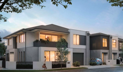
Council says future residents will benefit from the proximity to the Hawkstowe Train Station and existing services in the area, including schools and open space.
“Council has endorsed a plan that ensures this land is developed responsibly and in a way that meets the highest design and planning standards,” said Mayor, Lawrie Cox.
“This residential neighbourhood will deliver more than 200 new homes to support our rapidly growing community,” he said.
“Located close to public transport and just a short drive to schools, shopping and sports facilities, the development will suit the needs of people at all stages of life.”
Transport within the development plan area will be managed with a roundabout at the intersection between McArthurs Road and Poppy Drive and a pedestrian path network to encourage walking to the nearby Hawkstowe Train Station.
The heritage listed ‘Moorilla’ homestead, which is located on the site, will be protected and the plan contains guidelines for its eventual restoration, subject to future planning approval.

Due to parts of the site having been used for farming, approval conditions require a Statement of Environmental Audit to be issued before the second stage of works start.
The draft Development Plan was exhibited for four weeks in 2025 to allow relevant authorities and residents in the surrounding area to provide feedback.
